After the mediocre to fair nights described in (1) and (2), here are my observations during the next two following nights (August 31th to September 1st and 1st to 2nd). Those two nights have been somewhat cloudy, but with a much better seeing. Meteorological conditions had changed too !
During the night from August 30 to 31, I noticed that the unconfortable south-east wind, invisible on charts (see part 2) had stopped. During the day of August 31st, weather in France is changing: the meridional (southern) flux, responsible for the 2015 summer heat and that was still in place during our arrival at the observatory, is shifting to Italy. This was with the progressive installation of a cold front located west of France, in front of a low-pressure descending from Great Britain. Before the front, air is still warm and powerful thunderstorms are developing in the south-west air flux. The figure below presents the situation.
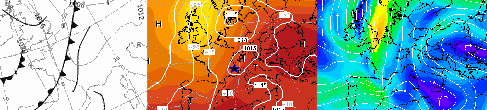
Left: position of fronts (UKMO); center: pressure systems; right: jet-stream. We progressively pass to a western flux in altitude. Ground wind is still undetermined so I do not show this data here.
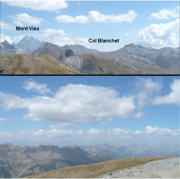
Here are some daytime pictures that look relevant to me (clic for a better resolution). Above: the depht of Queyras Valley as in the preceding article, but without the clouds that were “sinking” from Italy. The Viso Mount is largely free of clouds too, and the Blanchet pass that marks the frontier is visible as well.
At the bottom: at western horizon, fair weather cumulus are forming above french Alpes. Thoses clouds sign the presence of a mild convection (only due to solar heating) and were not present during the preceding two days.
Only a brief window of clear night was caught that night but it allowed me to take images of Neptune under good seeing. There was no sensible nighttime wind.
From September 1st to 2nd: a superb steady sky… but still not completely clear!
On the next day, the sky is largely covered with a very low cloud basis: the cold front has arrived over eastern France. This was the occasion to take pictures of some curious weather phenomena, like the famous “glories”… to be seen on the blog of my fellow astronomers of the Olympus Mons club :).
On the “macro” meteo side, the situation of the preceding day is reinforced with an obvious western wind in altitude, with a faster jetstream. In my usual lowland site, I would not have trusted the seeing offered by such a situation… None the less this is when I met the best steady conditions on Neptune. The sky was unbelievable, but still quite cloudy. Here are the relevant meteo charts:
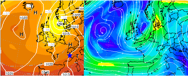
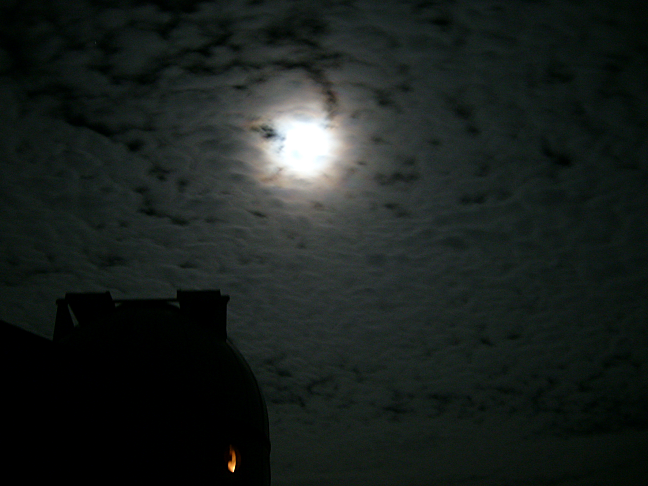
Pressure action centers at left: the air pattern is dominated by a vigourous low pressure (T) center on Danemark. On its southern flank (whole France) the westerlies create a noticeable jetstream (right chart, green color). The night ambiance was fantastic, with ghosts clouds illuminated by the Moon… that unfortunately won the battle against the telescopes.
Some of those clouds attracted my attention, as I had already seen them on lowland skies, accompanying a rock-steady seeing. I’m not sure to identify them correctly; they were either cirrocumulus or alto-cumulus. Here they are, in front of the Moon with the T60 dome at first plan:
During the following nights (2 to 3 and 5 to 6 September): persistent good conditions
The seeing during those two nights was again very good. Meteorological conditions remained the same: a relatively high western jet-stream on the southern flank of a “farewell” low-pressure.
: a strange wind at night")
